Back in "The Day," when cyclists rode leather saddles, Merckx was a word whispered in reverence and shorts were wool that didn't embarrass the neighbor's daughter, I used highway maps($0.75) when touring. It was a complex system, look at the map, find a major highway leading to your destination, look 1/2 to a mile on either side and find a county road running parallel to it. Those roads were only used by local hooligans, escaped convicts and farmers, consequently they were safe to travel by bike. Now days, we are relieved of those difficult decisions by new stuff hooked up to that interweb thing my son makes a livin' at, and I am writing on now. With several short and one really long trip coming up, I thought it good to review the current methods, kind of a dry run since I know the route I am using this weekend.
I have this Samsung Galaxy tablet my son recommended because he likes androids; says they are more natural to computers than fruit. I don't know, but I have gotten fond of what this thing does. When it comes to maps, I have that neat little map icon on the desktop

when I tap it, the map tells me where I am.

That's the comforting cool part; it's GPS enabled either through wi-fi or the cell phone carrier you choose.
I rely on the wi-fi since it is so easy to find these days. When I ask for directions to a destination and indicate bicycling

I get these really detailed, written directions along with mileage and estimated travel time.

If I hit the map icon in the corner, I get a great map with the route marked and


But on the other hand, I have the directions retained in detail to help navigate the void.

Will this be useful on the trip this weekend? No, because I already know where I am going, and if I didn't, these directions would have added 25 miles to the 120 mile trip. The Google bike directions are in Beta testing and are a work in poor progress. They led me 5 miles out of my way leaving Kalamazoo and another 20 miles out of my way in the Muskegon area to arbitrarily ride an existing MUP, presumably to glance at Lake Michigan before doubling back to my destination.
There is another option which can be used on a tablet. Most city and state DOT's have consulted with local bike nu...ah advocates and produced maps of preferred bike routes through their areas. The city of Grand Rapids
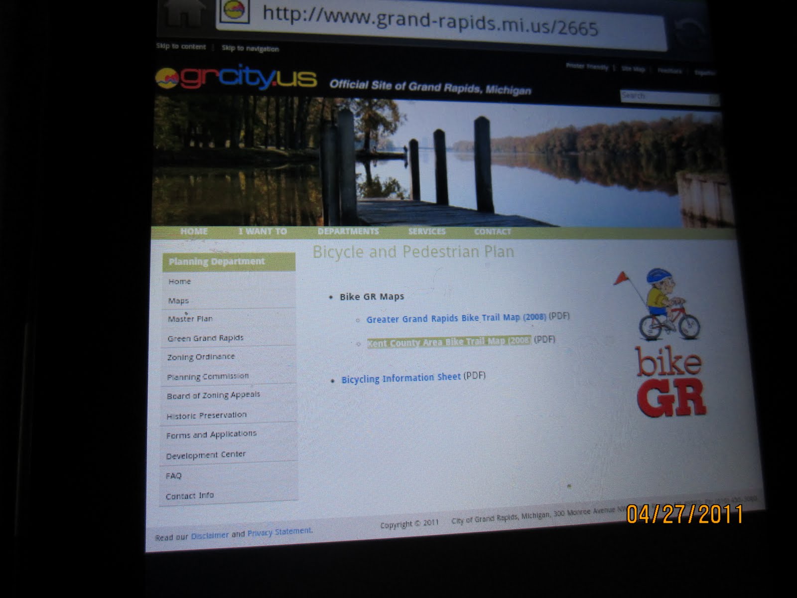
has this free PDF version available for download:

The state of Michigan has maps available by area

Wisconsin has a county by county directory available

I'm sure other states have the same service available. Used in conjunction with the Google maps feature offered by Android systems these could be both helpful and convenient when traveling. The advantage to downloading an existing map is two fold, you can plot your own route and not be dependent upon the internet or cell-phone carrier. After all, you wouldn't want an internet Beta test to interfere with an important intercultural experience like locating that quaint little bordello in SW Buttheadistan.
Another option is a service like Adventure cycling or a tour service. If you pay them, they will tell you where to go.
Now wasn't that simpler than buying a map and looking at it? Thank yourself for saving the bark from a tree, the internet is doing wonders.
No comments:
Post a Comment